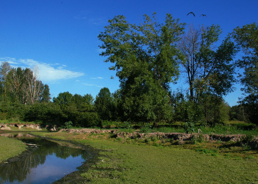

Clearly, we can tell that an area is healthy when there are living beings thriving on the land. The most visible sign of health then, are trees. Whether it's a Boabob or a common pine. Trees are the canary in the coalmine for the health of a region. Incredibly, forests actually create their own local rainfall through ‘evapo-transpiration.’ (link) (link) This is why deforestation regularly leads not only to soil loss but also to less frequent rains and desertification.
There are even fears that the damage to the Amazon Rainforest could eliminate the rains that keep the Panama Canal functioning.
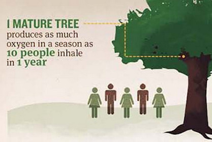
Trees are very much the lifeblood of our planet, providing oxygen, rainfall, shade, and homes for animals.
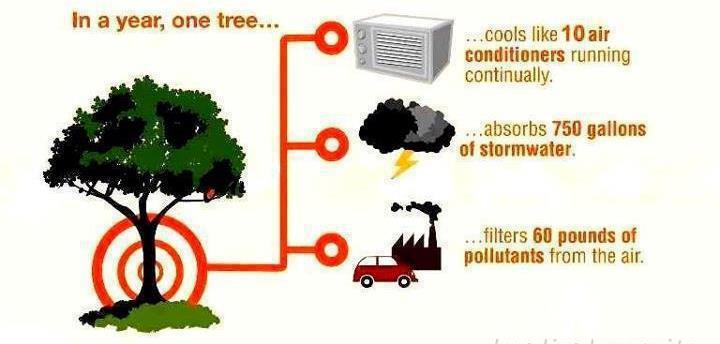
They absorb pollution, build topsoil, cool the air, absorb stormwater, and support mushrooms.
Forests of trees are also carbon sinks (the opposite of a coal plant). They store more CO2 emissions than they create.
So when you see a tree, feel free to give it a hug (it won't get embarrassed).
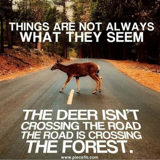
Besides being cut down for firewood, trees are also cut down to make way for roads, grazing land, or industries like fossil fuel drilling.
On top of that, the loss of forests have been linked to disease outbreaks like Sars and Ebola. (link) The protection of our trees is critically important, especially in light of new evidence that deforestation is found to have twice the effect on global warming then scientists previously thought.
Transportation has a huge impact on the health of our land. Worldwide, a whopping 247,600 km2 (95,357 mi2) of land is devoted to roads and parking. (link)
This results in paved areas consuming more than a third of the land surface within many North American cities. (link) (link) In Los Angeles alone a whopping 1,700 hectares of land (over 6.5 square miles) are devoted just to parking cars.
What many business owners don’t realize, is that the vast seas of asphalt separating them from the street actually hurts their profit margin as well as the vitality of the city. (link to economics)
But why is it that we devote so much of our precious land to transportation? How did we get to this strange situation that we’re in?
The reason is partly due to the size of the cars themselves and partly to the speed.
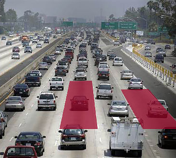
A traveling car creates a vacuum of space around it that would be dangerous for anyone else to use. This unused space can be 1000 sq. ft. for local trips to several thousand square feet on the highway. (link)
This means that the average car, traveling at highway speed can occupy as much space as a small house! (link) (link) This, just to carry a single person from point A to point B.
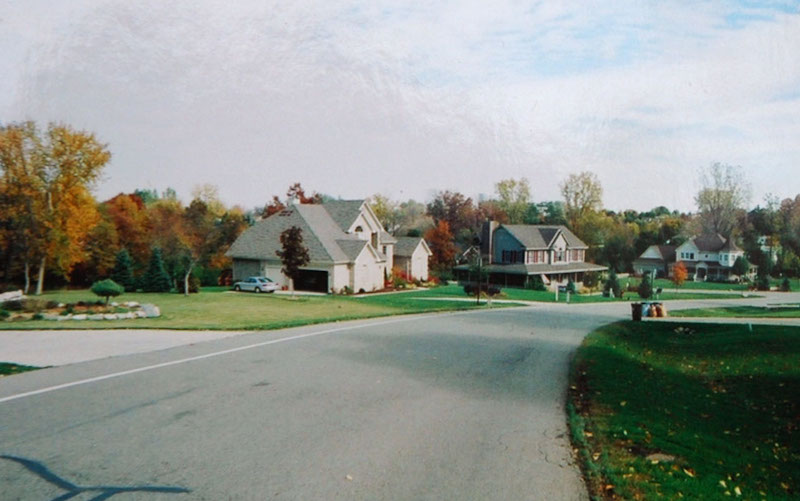
All of this space taken up by roads and parking lots means that the people who use them become more distanced from each other.
In older neighborhoods a person could connect with half a dozen people without crossing the street, but in modern suburbia reaching the same people would mean a trip 2-3 times as far- just to say hello. (more on this here)(link2 emot health)
One way to show this is with a term coined by Clarence Eckerson Jr. of Streetfilms.
It’s called a ‘sneckdown’ and it means a pattern in a snowy road that gets avoided by drivers, revealing space that could be transformed for higher purposes.
The crazy thing, is that despite what North Americans might believe, some experts are beginning to understand that it’s actually big roads that bring more cars and not the opposite. (link) (link) (link)
This is called ‘induced demand’ or the “if you build it they will come” idea.
After hundreds of examples where city planners added more lanes to crowded highways, the only thing that they got was - more traffic. (link) Becuase they were making it easier for people to use the least efficient travel option. So the traffic got worse and the highways continued to consume more of the city.
It works in the opposite way too. When roads narrowed or lanes are removed, the traffic actually gets better. (link) (link) It’s a lesson that transportation officials in Denmark and Copenhagen learned decades ago, but which North America hasn't yet come to terms with. (link)
For those who ARE able to see this reality, there has been an embrace of a new idea called the ‘road diet.’ This means slimming a road from 4 lanes to 3 or even 2; leaving room for bike lanes, dedicated bus lanes, or a tree-lined median. There's a huge number of examples showing that removing lanes results in calmer traffic, lower speeds, and reduced crashes. (link) (link) (link) (link)
But why is so much valuable land given over to a car which sits parked 95% of the time?
Well, for the answer to that we must look at early 20th century U.S. culture. This was a time of skyrocketing car use and people who drove were demanding that politicians bow to their need to store each vehicle.
This caused planners to create minimum parking requirements. (link) Yet despite this, modern drivers still find themselves devoting hours of time in their search for that elusive parking spot.
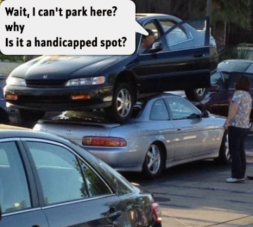
Because, just as with road space, parking will be filled as soon as it’s created (or even when it’s not created).
As with roads, increased availability of parking leads more people to see driving as a convenient option compared to bicycles or (underfunded) transit. (link) Whether a car is powered by gas, electric, or even hydrogen- it still needs a parking spot. (link)
Berlin, Paris, and various cities in Japan and England, as well as some U.S. cities have done this. (link) It’s clear by now that the era of seeing properties with more than half the space devoted to autos has come to an end.
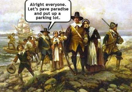
This huge demand for space to support high consumption means that forests and wild lands get squeezed out.
With such large swaths of land being negatively affected, it’s easy to see why so many environmental groups are pushing for more ‘roadless areas.’ (link) (link)
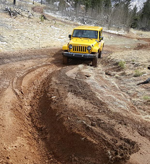
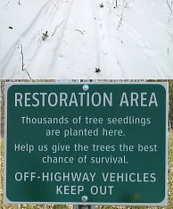
Speaking of roadless areas, there is a major threat to them as well. Vehicles and off-road machines driven for ‘wreckreation.’ These vehicles cause extensive damage to already fragile wilderness areas by harming vegetation and carving deep ruts in the soil. It can take years for an area to recover from such damage.
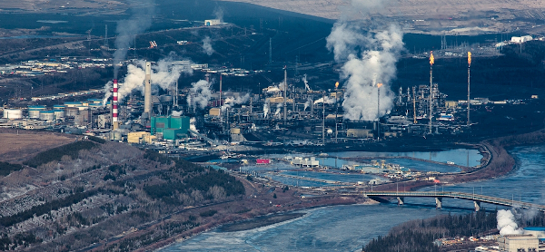
On top of the area paved over for the cars themselves, there’s also the destruction created in getting the fuel. Deforestation and habitat loss on a massive scale is connected with drilling, shipping, and storing all the resources connected to oil use. (link) (link) (link) The splurge in fracked oil from Alberta has been devastating to the once pristine forests of Canada. These operations are among the largest human-made structures on earth and they're filled with toxins. (link)
So if we don’t want to use a car, then what alternatives are there?
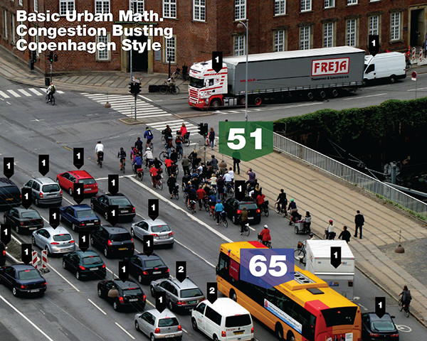
Well as with plant-based food the alternative is - everything else.
Walk, ride a bike, use e-scooters, take the bus, use light-rail if your community has it.
Just like with all other decisions to reduce our impact, each person who embraces compassionate habits brings about hugely positive results not only for themselves, but also for everyone else nearby.
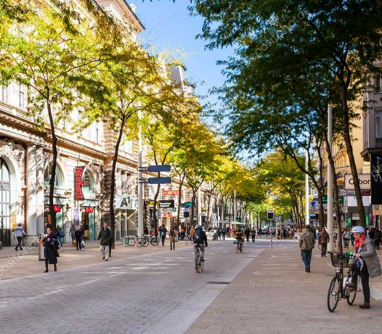
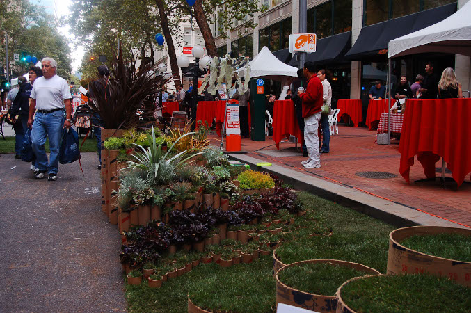
Think of how much more peaceful your day would be with no car horns. Imagine if there were mini-playgrounds or trees where curbside parking now sits.
When I was growing up, there was bus service but it was infrequent and under-funded (see the‘Cost’ section) so the bike was more practical.
Nowadays many cities have frequent bus service and a few even have dedicated lanes so your bus doesn’t get caught behind the less efficient cars.
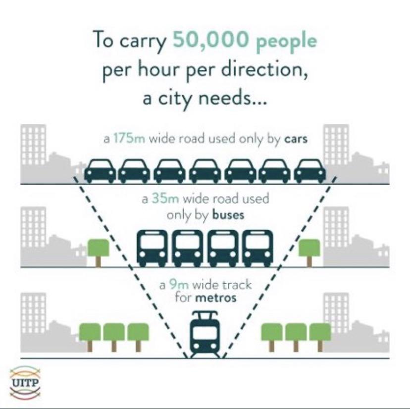
When it comes to saving road space, public transit is the reigning champion, even more so than walking or biking. Jeff Speck proposes that every passenger mile traveled by rail replaces nine miles by car. Public transit is especially valuable for those who can't travel by human power and for going long distances.
Worldwide nearly half of the usable land on earth, more than 4,000,000,000 hectares, are eaten up by the livestock industry.
This is consumed either for grazing land or croland to grow animal feed.
This makes the breeding of animals for food, the single largest use for our precious habitable land (link) (link) and the largest contributor to wildlife loss.
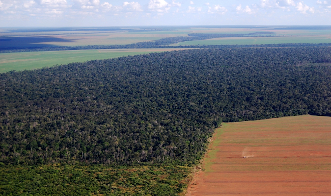
Some defenders of the status-quo claim that expansion of farms only uses degraded lands.
Researchers have shown that this is not true. In fact, forests are the areas most threatened by expanding animal operations. (link) (link)
Tobacco, weed, beer, and whiskey are all made from plants...
I think I might be a vegetarian
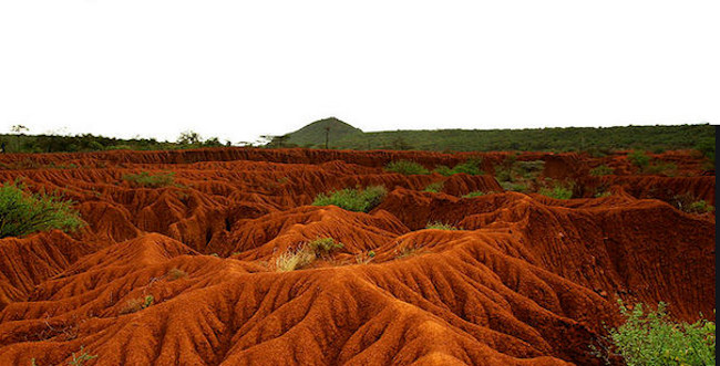
The land needed for dairy cows is so huge, it extends for miles and miles past-your-eyes
The food and water supply for all the world's creatures is closely connected to healthy soil.
In addition to forests, other fragile areas like peatland, mangroves, semi-desert land, prairies, and mountain slopes become degraded as they are transformed into land which can be used for breeding animals.
Drained peatland alone contributes 10% of all agriculture/forest emissions. (link) This is because peatland stores nearly 1/3 of all carbon that remains in the world's soil. (link)
The biggest consumers of land are obviously cows, which need 2-4 acres for every single animal to graze.
This doesn’t include the feedlots which use less land per animal compared to ‘free range’ livestock because those animals are kept in more ‘efficient’ [crowded] stalls. (link) The more crowded confined animal operations create another little-known hazard. Giant lakes of animal waste from the hundreds of cows or pigs. (link)